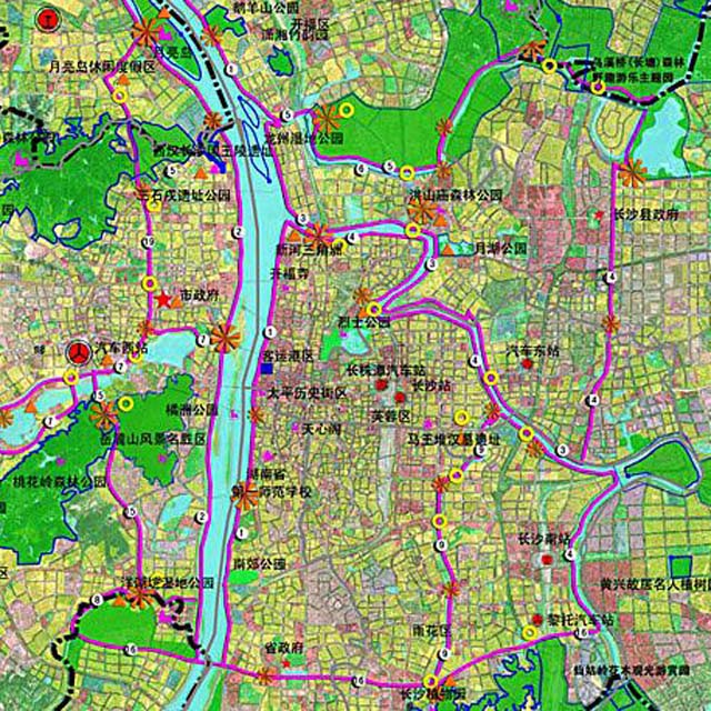
The planning map of Changsha's greenways in a short term period (by 2015)
The Changsha Urban and Rural Planning Bureau announced on January 3, 2014 that Changsha's greenways is expected to reach 1,336 kilometers long in total, including 12 greenways covering the administrative urban area and 21 city greenways, proposed in the Special Planning on Changsha's Greenways (2012-2020) to be released.
The greenway is a linear green open space usually built along the natural and artificial corridors such as riverside, valleys, ridges, and scenic roads, with a footpath and cycleway set up for sightseeing and rest.
The construction of greenways in Changsha will be carried out in a short-term period (by 2015) and a long-term period (by 2020).
Twelve greenways are planned to be built by 2015, along which 30 post houses and service stations are projected to be set up.
The twelve short-term greenways are East Bank of the Xiangjiang River Greenway, West Bank of the Xiangjiang River Greenway, South Bank of Liuyang River Greenway, North Bank of Liuyang River Greenway, Laodao River Greenway, Longwang Harbor-Meixi Lake Greenway, Guitang River Greenway, Yanghuyuan Greenway, Xiangfu Road Greenway, Jinxing Road Greenway, West 2nd Ring Road Greenway, and Xingsha Avenue Greenway.